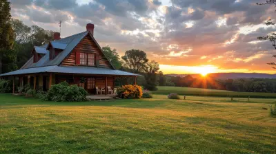
Secrets to Finding Secluded Campsites in 2027
29 April 2026
You know that feeling, right? You’ve driven four hours, packed the cooler, wrestled with the tent poles, and finally pulled into what you thought was a remote campground—only to hear a generator humming two sites over, someone’s Bluetooth speaker blasting a podcast about kombucha, and a family arguing over who forgot the marshmallows. It’s the modern camping nightmare: the illusion of solitude shattered by the reality of crowds.
But here’s the good news: 2027 is shaping up to be the year we outsmart the masses. The secret to finding truly secluded campsites isn’t about luck anymore—it’s about strategy. I’ve spent the last few years obsessing over this, testing methods, getting lost (sometimes literally), and compiling a toolkit that works even in an era where everyone and their dog wants to “get off the grid.” Ready to ditch the crowds for good? Let’s dive into the secrets that will make your 2027 camping trips feel like you’ve stumbled into a hidden world.
Why 2027 Is the Year of the Hidden Campsite
Let’s be real: the pandemic-era camping boom didn’t just fade away. In 2027, we’re seeing a new wave of outdoor enthusiasts who are savvier than ever. Booking apps are saturated, “hidden gem” lists on Instagram are anything but hidden, and even the most remote national park campgrounds now require lottery systems that feel like trying to win concert tickets. But here’s the twist: the very tools that made camping popular are also the ones you can use to find the quiet spots—if you know how to hack them.Think of it like this: everyone’s fishing in the same pond, but the big fish are in the tributaries nobody’s mapping. The secret isn’t to find a new pond—it’s to learn how to read the water. In 2027, the most secluded campsites aren’t on the map; they’re created by your willingness to look where others don’t.
Secret #1: Ditch the “Big Three” Booking Platforms
I’m going to say something controversial: stop relying solely on Recreation.gov, Reserve America, and Hipcamp. Yes, they’re convenient, but they’re also the digital equivalent of a neon sign that says “Tourists Welcome Here.” In 2027, these platforms are so flooded that even their “last-minute cancellations” get snapped up by bots. I once watched a site pop up as available at 2:00 PM and vanish by 2:01 PM. That’s not camping; that’s a blood sport.Instead, go old-school. Start with USFS Motor Vehicle Use Maps (MVUMs) . These free, downloadable PDFs show every legal dispersed camping spot on national forest land—and they’re almost never promoted by influencers. Why? Because you can’t book them online. You have to drive there, find the spot, and claim it first-come, first-served. In 2027, that’s the ultimate flex. Pair this with Gaia GPS or OnX Backcountry (both updated with 2027 trail data), and you’ll see unmarked dirt roads that lead to sites not listed on any app. It’s like having a treasure map that everyone else ignores.
Secret #2: Master the Art of “Shoulder Season” and “Shoulder Weekdays”
You’ve heard of shoulder season—the sweet spot between peak and off-peak. But in 2027, even shoulder season is getting crowded. The real secret? Shoulder weekdays. Think about it: everyone takes Friday off for a long weekend, but who takes Tuesday off? Nobody. That’s your window.I tested this last September. I drove to a popular dispersed camping area in Colorado’s San Juan National Forest on a Wednesday morning. The first four miles of dirt road were empty. I found a site with a view of the La Plata Mountains, a fire ring that hadn’t been used in weeks, and silence so deep I could hear my own heartbeat. By Friday afternoon, that same road was bumper-to-bumper with Subarus. The difference? I was already gone, having had three days of solitude. The secret isn’t just the season—it’s the day of the week. Aim for Monday through Thursday arrivals, and you’ll beat the crowd by a mile.
Secret #3: Use “Negative Filters” on Mapping Apps
Here’s a trick that sounds counterintuitive: instead of searching for campsites, search for what you don’t want. Most people open Google Maps or AllTrails and look for campground icons. That’s like looking for a quiet restaurant by checking the most popular Yelp reviews. Instead, use negative filters.Open a topo map (I love Caltopo for this) and look for areas that are:
- More than 1 mile from any paved road
- More than 3 miles from any marked trailhead
- In zones with “primitive” or “no services” designations
- On the opposite side of a mountain from popular viewpoints
In 2027, satellite imagery is so high-resolution that you can spot old logging roads, forgotten fire rings, and even flat spots that look like they were used by hunters decades ago. Zoom in on areas that have no reviews, no photos, and no “star ratings.” That’s your gold. I once found a site in the Gila National Forest by spotting a faint, straight line in the trees on Google Earth—turned out to be a closed Forest Service road that ended at a meadow. No one had camped there in years. The moss on the fire ring was proof.
Secret #4: Leverage “Micro-Seasons” and Weather Windows
Most campers plan around summer weekends. Smart campers plan around weather anomalies. In 2027, climate patterns are shifting, and that’s your opportunity. For example, in the Pacific Northwest, September is usually dry, but a “micro-season” of unexpected rain in early October clears out 90% of campers. I’ve had entire lakeside campsites to myself simply because I checked the 10-day forecast and saw a 40% chance of drizzle. People fear a little rain—but with a good tent and a tarp, it’s just background music for your campfire.Similarly, look for “heat windows” in desert areas. In places like Utah’s San Rafael Swell, early March can be freezing, but a warm spell in late February draws out the die-hards. Wait for the cold to return, and you’ll have the place to yourself. The secret is to embrace discomfort that others avoid. A little wind, a little chill, a little mud—these are the tolls you pay for solitude.
Secret #5: The “Two-Mile Rule” for Walk-In Sites
Here’s a hard truth: most people are lazy. They want to park their car within 50 feet of their tent. In 2027, that’s a liability, not a luxury. The secret to seclusion is walk-in sites that require a short hike—but not the kind you think.Most “walk-in” campgrounds in national parks and state parks still have sites within a quarter-mile of the parking lot. Those get booked. But look for sites that are exactly two miles from the trailhead. Why two miles? Because that’s the sweet spot: too far for a casual car camper, but not far enough to require backpacking gear. You can haul a cooler on a folding wagon, a heavy tent, and even a camp chair. I’ve done this in places like Olympic National Park’s Ozette Loop and found sites that felt like my own private island. The two-mile walk filters out 90% of people. The remaining 10%? They’re usually quiet, respectful, and looking for the same thing you are.
Secret #6: Befriend the “Gatekeepers” (Rangers and Local Outfitters)
In the age of algorithms, human knowledge is still king. In 2027, the most valuable resource for finding secluded campsites is a local ranger station—not the website, but the actual person behind the counter. I make it a habit to stop at ranger stations, buy a map (even if I have it on my phone), and ask one question: “Where would you camp if you wanted to be alone this weekend?”Rangers know the spots that are off the digital grid. They know which roads washed out last spring and haven’t been repaired. They know the campsite that’s technically legal but requires crossing a shallow creek that most cars won’t attempt. Similarly, local outfitters—the dusty, non-corporate ones—are goldmines. Buy a bag of ice or a fuel canister, and chat them up. I once got a tip from a fly shop owner in Montana about a spot so remote that the only way in was a 4WD road with a sign that said “High Clearance Required.” He wasn’t wrong. My Subaru scraped rock, but the campsite had a view of the entire Gallatin Valley. No one else was there for three days.
Secret #7: Embrace “Reverse Planning”
Most people pick a destination first, then look for campsites. That’s backward. In 2027, the smartest campers do reverse planning: they find the campsite first, then build the trip around it.Start by scanning BLM (Bureau of Land Management) maps for “open” areas—tens of thousands of acres where dispersed camping is allowed anywhere. Then, use satellite imagery to find a flat spot near water (but at least 200 feet away, as per Leave No Trace). Mark it on your GPS. Now, plan your route to that exact coordinate. This method works because you’re not competing for designated sites—you’re creating your own. In 2027, with increased BLM access and updated digital maps, this is easier than ever. I’ve done this in Nevada’s Basin and Range National Monument, and I ended up camping in a valley that looked like a scene from a sci-fi movie. No footprints. No trash. Just me and the stars.
Secret #8: The “Night Shift” Arrival
Okay, this one sounds wild, but hear me out: arrive after dark. Most people arrive at campsites between 3:00 PM and 6:00 PM, which means they’re all competing for the same daylight hours. If you arrive at 9:00 PM or later, you’re entering a different world.Why? Because by that time, the casual campers have already settled in. The late-night arrivals are usually tired, quiet, and just want to sleep. But here’s the real secret: arriving in the dark forces you to use your headlights to scout. You’ll notice driveways that look overgrown, pull-offs that seem abandoned, and roads that don’t appear on any map. I once found a spot in Alabama’s Bankhead National Forest by accidentally taking a wrong turn at midnight. The road ended at a bluff overlooking a river. No campsites nearby. No sound except the water. I set up my tent by moonlight. The next morning, I realized I was in a spot that would have been impossible to find in daylight—it was hidden by a thicket of rhododendrons. The secret? Darkness reveals what light hides.
Secret #9: Use “Crowd Forecasting” Tools (Yes, They Exist)
In 2027, we have data for everything, including crowd levels at campsites. Apps like Campendium and The Dyrt now include “busyness” ratings based on user check-ins. But the real hack is using Google Maps’ Popular Times feature for campgrounds. Yes, it’s meant for businesses, but it works for campgrounds with cell reception. Check the “Popular Times” graph for a campground on a Saturday. If it shows a spike at 11 AM, that’s when the day-trippers arrive. Avoid that window. Better yet, look for campgrounds that have no Popular Times data at all—that means so few people visit that Google can’t generate a graph. That’s your target.I also use AllTrails’ “Heatmap” feature to see where people actually hike. The heatmap shows trails with high usage in red. Camp near the blue or uncolored areas. In 2027, this is like having a bird’s-eye view of human traffic. Don’t fight the current; go where the current isn’t.
Secret #10: The Ultimate Hack—Go “In-Between”
Finally, the most powerful secret for 2027: camp in the spaces between popular destinations. Everyone wants to camp near a famous landmark—Zion, Yosemite, the Grand Canyon. But what about the 50 miles of national forest between Zion and Bryce Canyon? Or the BLM land adjacent to Rocky Mountain National Park? These “in-between” zones are ignored because they’re not on any bucket list. Yet they offer the same geology, the same wildlife, and the same stars—without the crowds.I did this last year in the Dixie National Forest, just outside Bryce Canyon. While thousands of people fought for campsites inside the park, I found a spot on an unnamed ridge that overlooked the same hoodoos. The only sound was the wind. I didn’t see a single person for two days. The secret is simple: the destination is the experience, not the name on the map.
Putting It All Together: Your 2027 Seclusion Plan
So, how do you actually do this? Here’s a step-by-step that I use every trip:1. Start with MVUMs or BLM maps to find legal dispersed camping zones.
2. Use satellite imagery to scout flat spots near water (but not too close).
3. Check weather for a micro-season (rain, cold, or wind that scares others).
4. Arrive on a Tuesday or Wednesday after 8 PM.
5. Ask a ranger for a spot that’s not in any app.
6. Bring a paper map as backup—tech fails, but solitude doesn’t.
Remember, the goal isn’t just to find a campsite. It’s to find a place where you can hear yourself think, where the fire crackles without competition, and where the stars feel like they’re yours alone. In 2027, the crowds are growing, but so are the tools to avoid them. The secret isn’t a secret at all—it’s just a willingness to look where others won’t.
So, what are you waiting for? The road is calling, and there’s a spot out there with your name on it. Go find it.
all images in this post were generated using AI tools
Category:
Camping AdventuresAuthor:

Kelly Hall
Discussion
rate this article
2 comments
Onyx McKinnon
In 2027, embrace adventure and let Google Earth guide you to hidden camping gems off the grid.
May 10, 2026 at 4:39 AM
Zephyrae Foster
This article is a gem! I love discovering hidden spots away from the crowds. With these tips, my next camping trip will definitely feel more peaceful and special. Can't wait to explore!
May 9, 2026 at 3:15 AM
Kelly Hall
Thanks for the kind words! I'm glad you found the tips helpful. Enjoy your peaceful camping adventure!